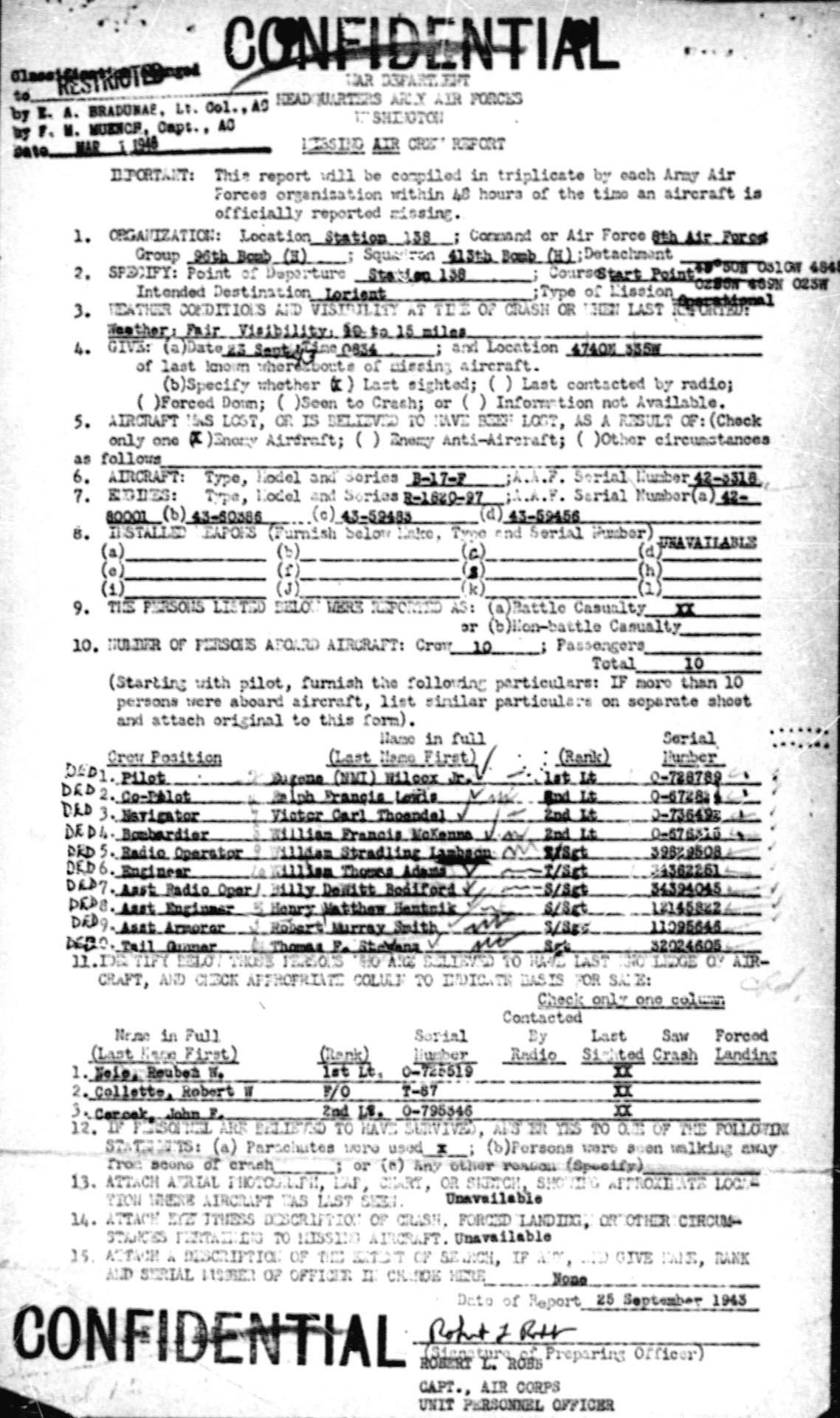
23 September 1943
Boeing B-17F-45-DL "Shack Rabbit II" (s/n 42-3318 code AW-M)
Island of Groix (56)
(contributors : Frédéric Hénoff, Daniel Dahiot, Geoffrey Gilllon, Linda Blakeney)
Crew (96th BG, 413rd BS) :
All crew members have the status of "Missing in Action or Buried at Sea" and are listed on the "Tablets of the Missing" at the "Cambridge American Cemetery" in England.
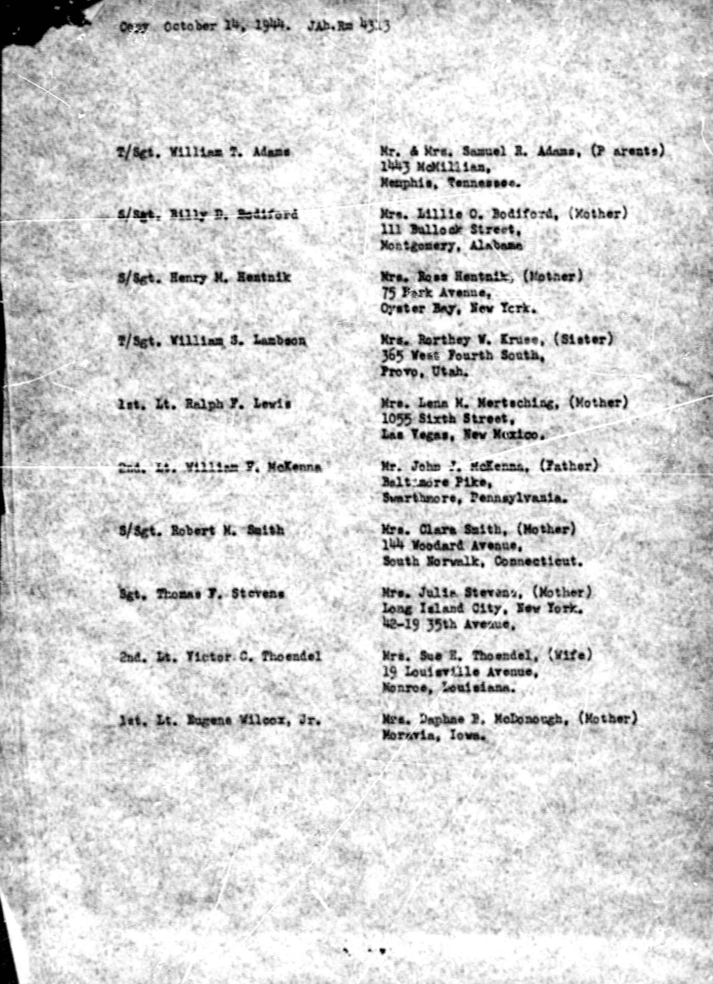
- (Pilot) 1st Lt Eugene WILCOX Jr., M.I.A. (service number O-728789)
Son of Mrs Daphne P. McDonough, Moravia, Iowa (USA)
Shot down a first time on July 28, in B-17 #42-30351 "Alcohol Annie" in North Sea. He returned to base.

1st Lt Eugene WILCOX Jr.
Photo American Air Museum - reference UPL 72418
- (Co-Pilot) 2nd Lt Ralph Francis LEWIS, 23 years old, M.I.A. (service number O-672824)
Born on April 28, 1920.
Son of Mrs Lena M. Mertsching, Las Vegas, Nouveau Mexique (USA)
- (Navigator) 2nd Lt Victor Carl THOENDEL, 26 years old, M.I.A. (service number O-736492)
Born on February 1, 1917.
Son of Mr and Mrs Joseph Thoendel, Ewing, Nebraska (USA).
Husband of Mrs Sue H. Thoendel, Monroe, Louisiane (USA)
(see marriage notice in appendice)

2nd Lt Victor Carl THOENDEL
Photo with courtesy of Andy - site Find a grave
- (Bombardier) 2nd Lt William Francis McKENNA, M.I.A. (service number O-676313 ?)
Son of Mr John J. McKenna, Swarthmore, Pennsylvanie (USA)
- (Radio operator - gunner) T/Sgt William Stradling LAMBSON, M.I.A. (service number 39829508)
Brother of Mrs Rorthey W. Kruse, Provo, Utah (USA)
- (Engineer - Top turret gunner) T/Sgt William Thomas ADAMS, M.I.A. (service number 34362251)
Son of Mr and Mrs Samuel R. Adams, Memphis, Tennessee (USA)
- (Assistant radio operator - Ball gunner) S/Sgt Billy Dewitt BODIFORD, M.I.A. (service number 34394045)
Son of Mrs Lillie O. Bodiford, Montgomety, Alabama (USA)
- (Assistant engineer - Waist gunner) S/Sgt Henry Matthew HENTNIK, M.I.A. (service number 12145822)
Son of Mrs Rose Hentnik, Oyster Bay, New-York (USA)
- (Waist gunner) Sgt Thomas F. STEVENS, M.I.A. (service number 32024605)
Son of Mrs Julia Stevens, Long Island city, New-york (USA)
- (Tail gunner) S/Sgt Robert Murray SMITH, M.I.A. (service number 11095645)
Son of Mrs Clara Smith, South Norwalk, Connecticut (USA)
THE STORY
The discovery and translation of German documents by Frédéric Hénoff informs us of the circumstances of the fall of this B-17F "Shack Rabbit II," sent on September 23, 1943, for a bombing mission on the Vannes airfield.
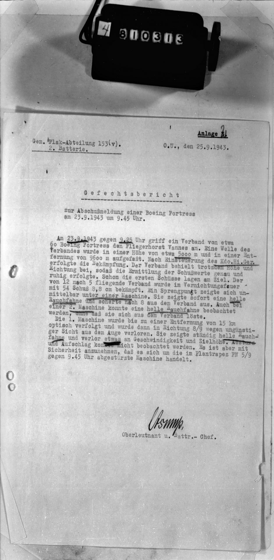
♦ Document T321-0061-00991 : Gem. Flak-Abteilung 153 (v). 2. Batterie - 25.09.1943
Combat report concerning the destruction of a Boeing Fortress on September 23, 1943 at 9:45 am.
On September 23, 1943, at approximately 9:25 a.m., a formation of about 60 Boeing Fortresses attacked the Vannes airfield. A wave of the formation was intercepted at an altitude of approximately 5,000 meters and a range of 9,600 meters. After setting the Kdo.Hi.Ger. (1), fire was opened. The formation nevertheless maintained its altitude and heading, which allowed for calm and precise fire control. The first shots already found their mark. The formation, flying from 12 to 5, was met with a destructive barrage of 54 8.8 cm salvos. A point of impact appeared directly beneath one aircraft. This aircraft immediately emitted a clear smoke and separated from the formation after 8 seconds. A clear smoke was also observed on a second aircraft, but it did not separate from the formation.
The first aircraft was visually tracked to a distance of 15 km, then lost sight of in direction 8/9 due to poor visibility. It was continuously emitting a light-colored smoke and had slightly lost speed and altitude. The descent and crash could not be observed. However, it can be assumed with certainty that this was the aircraft that crashed around 9:45 am in grid square FN 5/9.
(1) Kommandohilfsgerät : auxiliary fire control system and small optical rangefinder serving as an aid to the main fire control system.
Note: Location of the Flak battery : near Hill 120, 0.8 km northeast of Meucon [Vannes airfield].
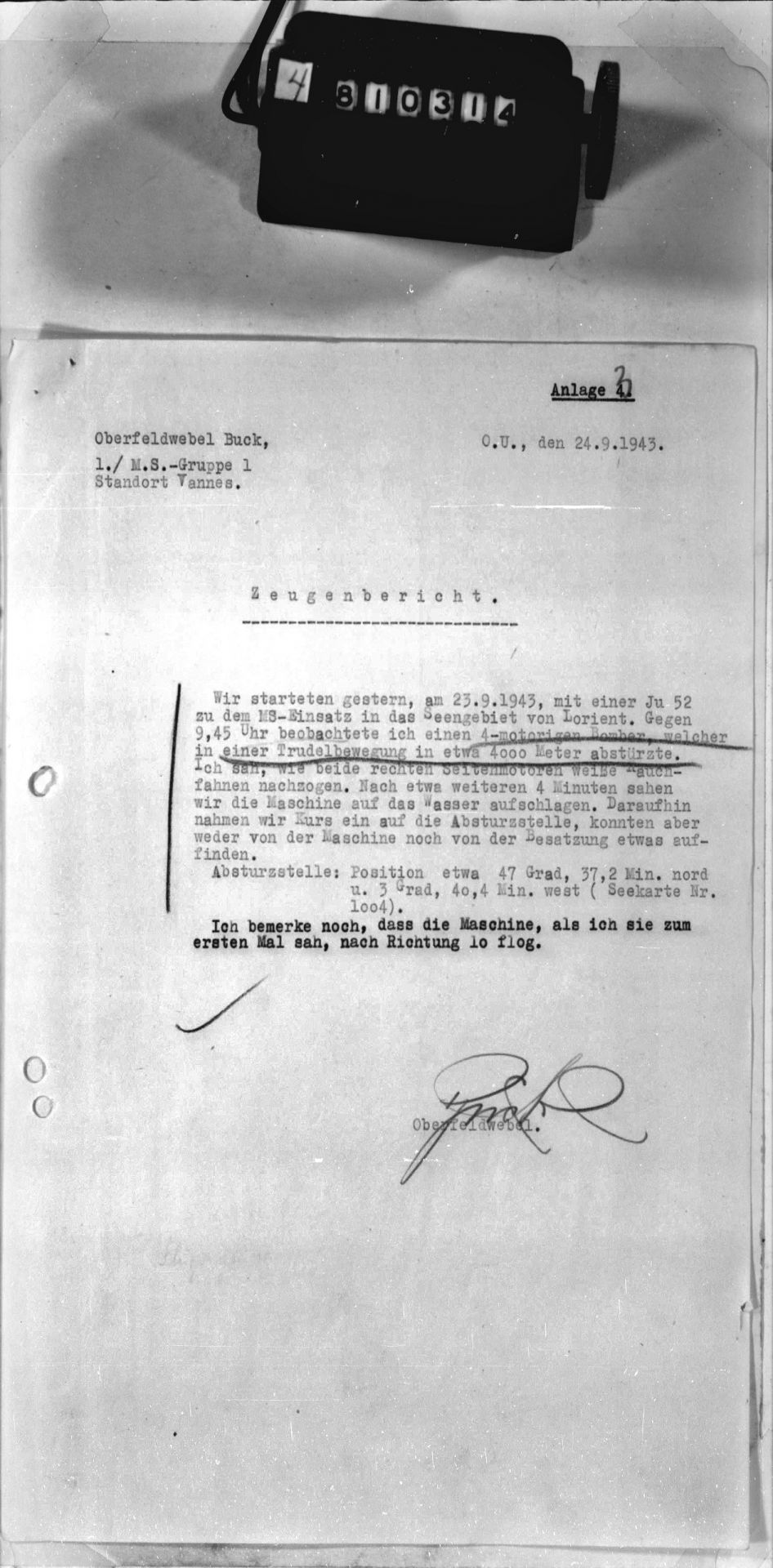
♦ Document T321-0061-00992 : Oberfeldwebel Buck - 1./M.S.-Gruppe 1 - Vannes Garrison - 24.09.1943
Testimonial
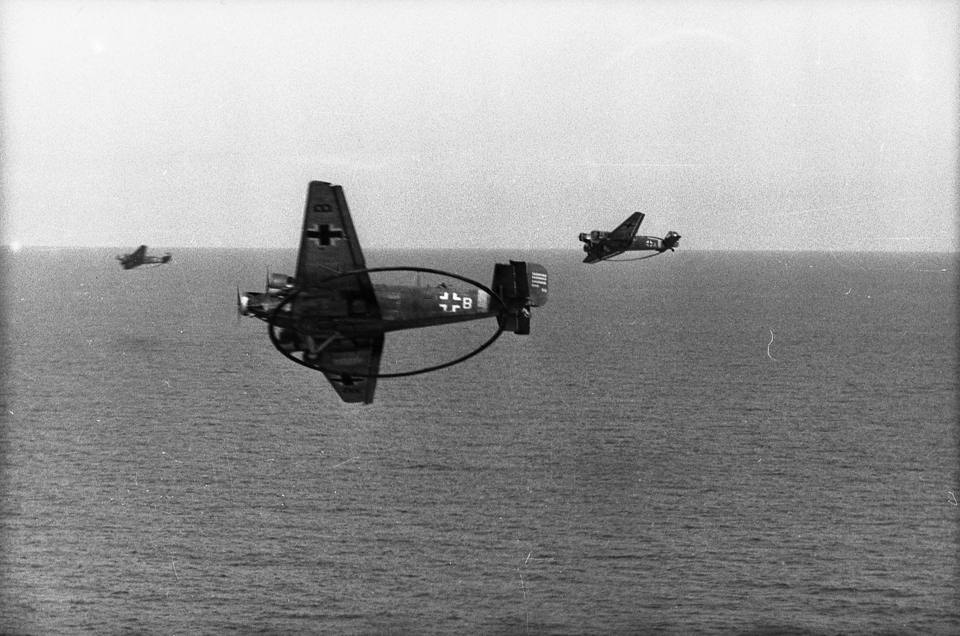
Junkers Ju 52 "Mausi" similar to the aircraft of Oberfeldwebel Buck of 1./M.S. ("Minen Such" for "minesweeper").
These aircraft were equipped with a 14-meter diameter current-conducting ring to create a magnetic field that detonated submerged mines.
Photo Bundesarchiv Bild 101I-643-4755-30A - Photographer Ohmeyer
" Yesterday, September 23, 1943, we took off in a Ju 52 for a mine-clearing mission in the maritime zone off Lorient. Around 9:45 a.m., I spotted a four-engine bomber that had crashed while spinning (in a spin) at an altitude of approximately 4,000 meters. I saw trails of white smoke coming from the two right-side engines. After about four minutes, we saw the aircraft hit the water. We then headed for the crash site but found neither the aircraft nor the crew. Crash location : approximate position 47 degrees, 37.2 minutes north and 3 degrees, 40.4 minutes west (nautical chart Nt.1004).
I also add that when I first saw the aircraft, it was flying in a direction of 10."
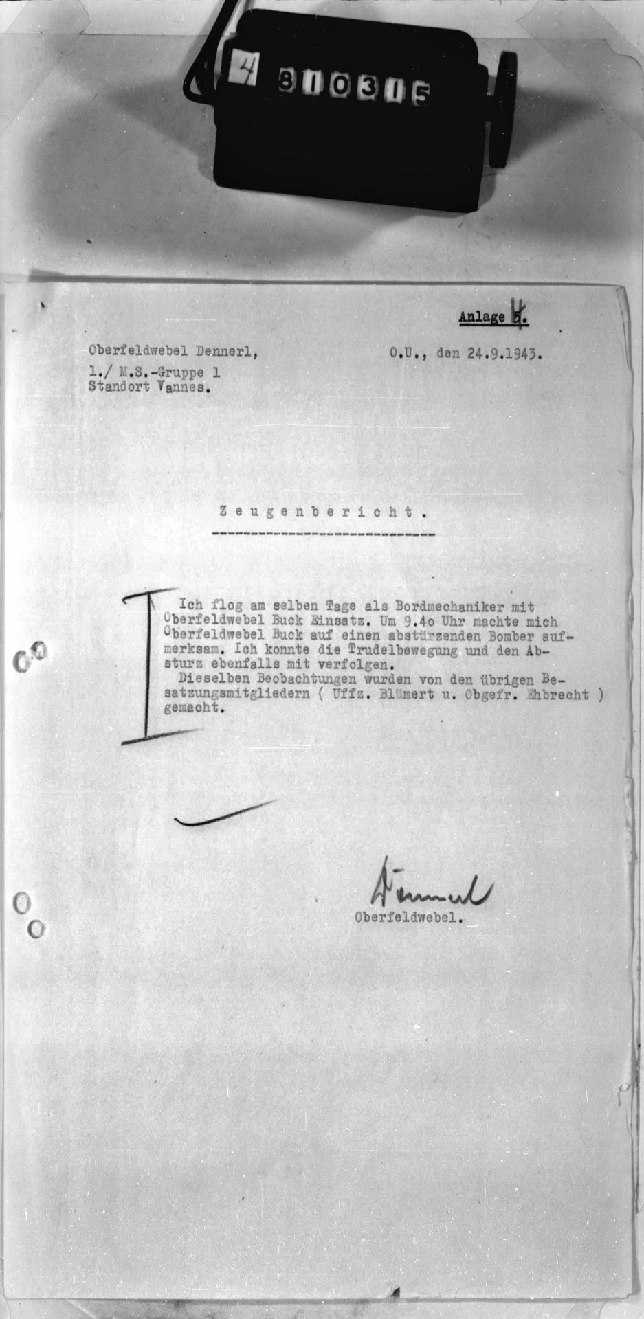
♦ Document T321-0061-00993 : Oberfeldwebel Dennerl - 1./M.S.-Gruppe 1 - Vannes Garrison - 24.09.1943
Testimonial
" I was flying that same day as a flight engineer with the Oberfeldwebel Buck. At 9:40 a.m., the Oberfeldwebel Buck reported a bomber crashing. I also observed it spinning and then crashing. The same observations were made by the other crew members (Uffz. Blümert and Obgefr. Ehbrecht)."
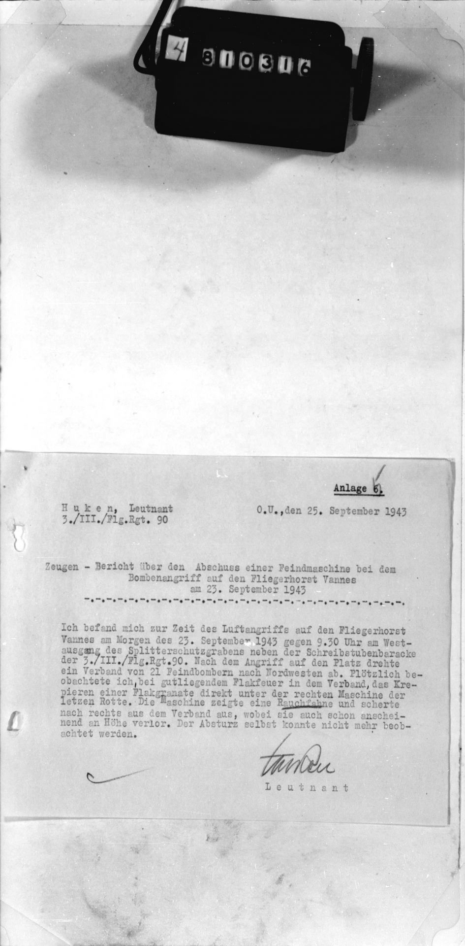
♦ Document T321-0061-00994 : Huken, Leutnant - 3. Kompanie/III./Flieger-Regiment 90 - 25.09.1943
Witnesses – Report on the Destruction of an Enemy Aircraft During the Bombing of Vannes Air Base on September 23, 1943
" At the time of the raid on Vannes airfield, on the morning of September 23, 1943, around 9:30 a.m., I was at the western exit of the splinter trench, next to the hut housing the secretariat of the 3rd Company of the III./Flieger-Regiment 90. After the attack, a group of 21 enemy bombers turned northwest. Suddenly, during anti-aircraft fire well-placed within the formation, I saw a shell explode just below the aircraft on the right of the last box. The aircraft emitted smoke and moved to the right of the formation, already appearing to lose altitude. I was unable to see the crash itself."
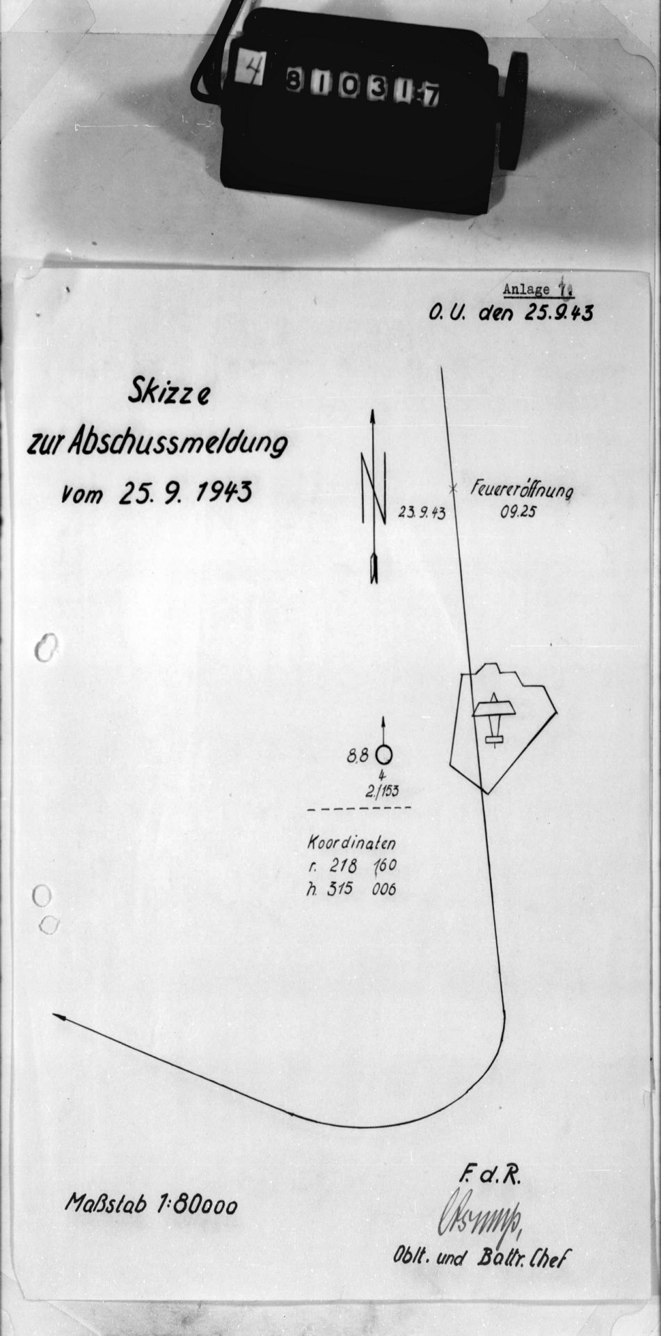
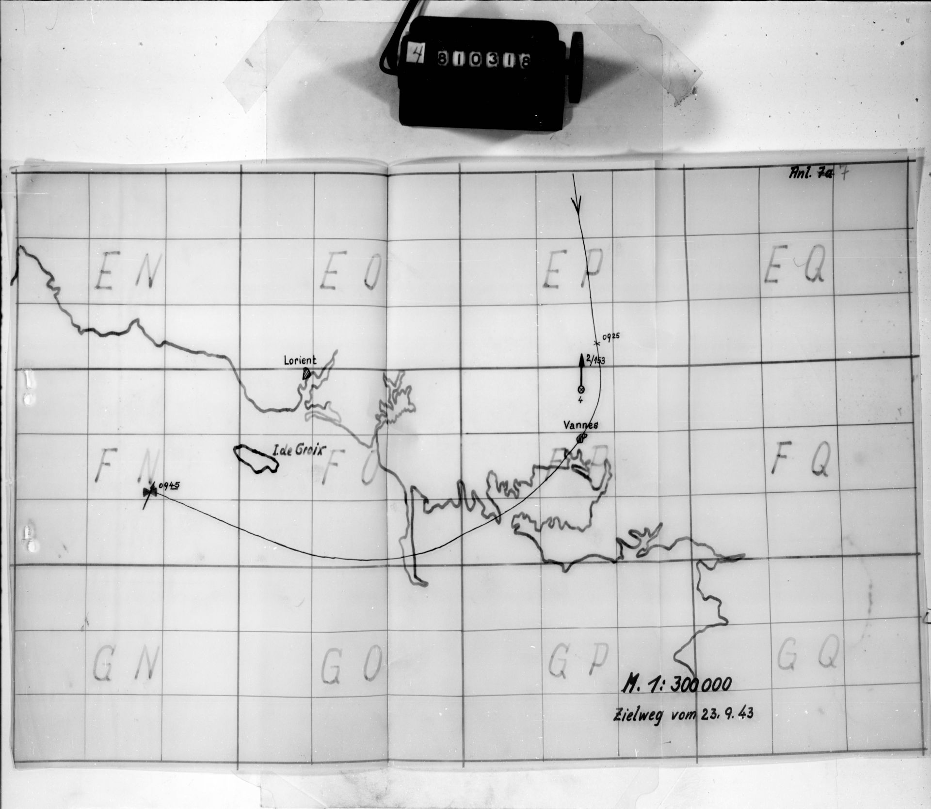
♦ Documents T321-0061-00995 et 00996 : two sketches
These documents (see appendices) appear to indicate the aircraft's flight path on September 23, 1943 : the aircraft arrived from the north, the flak opened fire at 9:25 a.m. ["Feueröffnung"] shortly before the airfield, then turned right towards the coast and thus towards the island of Groix, where it crashed off the coast at 9:45 a.m. (blue dot). This is what it looks like :
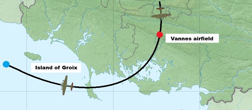
Sketch (source Wikipedia) based on a map created by Eric Gaba, used according to the Creative Commons Attribution-Share Alike 3.0 Unported.
The map has been modified : it has been cropped and the aircraft's route has been added.
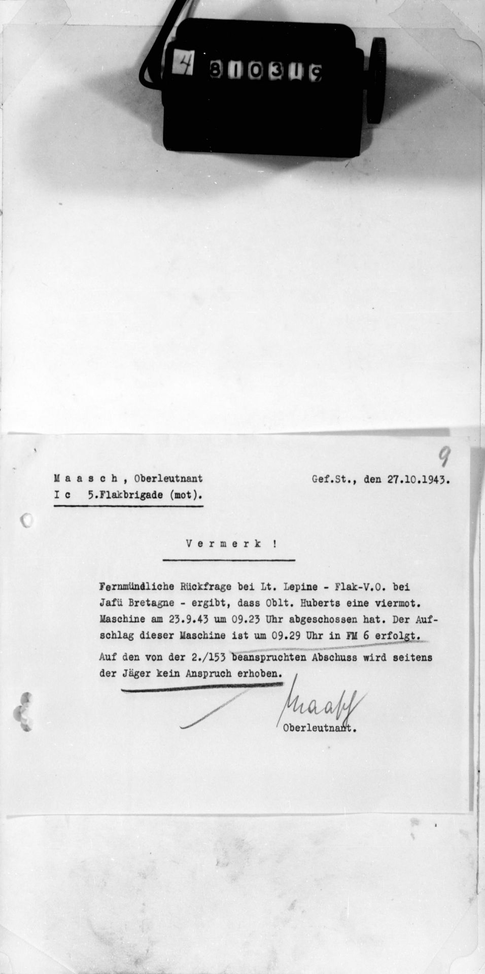
♦ Document T321-0061-00997 : Maasch, Oberleutnant - Ic 5. Flakbrigade (mot). - 27.10.1943
Comment
" A telephone verification with Leutnant Lepine (Friedrich) – Flak liaison officer at Jafü Bretagne – reveals that Oberleutnant Huberts (Correction : Oblt. Huppertz Herbert) shot down a four-engine aircraft on September 23, 1943, at 9:23 a.m. The crash of this aircraft occurred at 9:29 a.m. in square FM 6. Regarding the shot claimed by 2./153, the fighters do not assert their claim. "
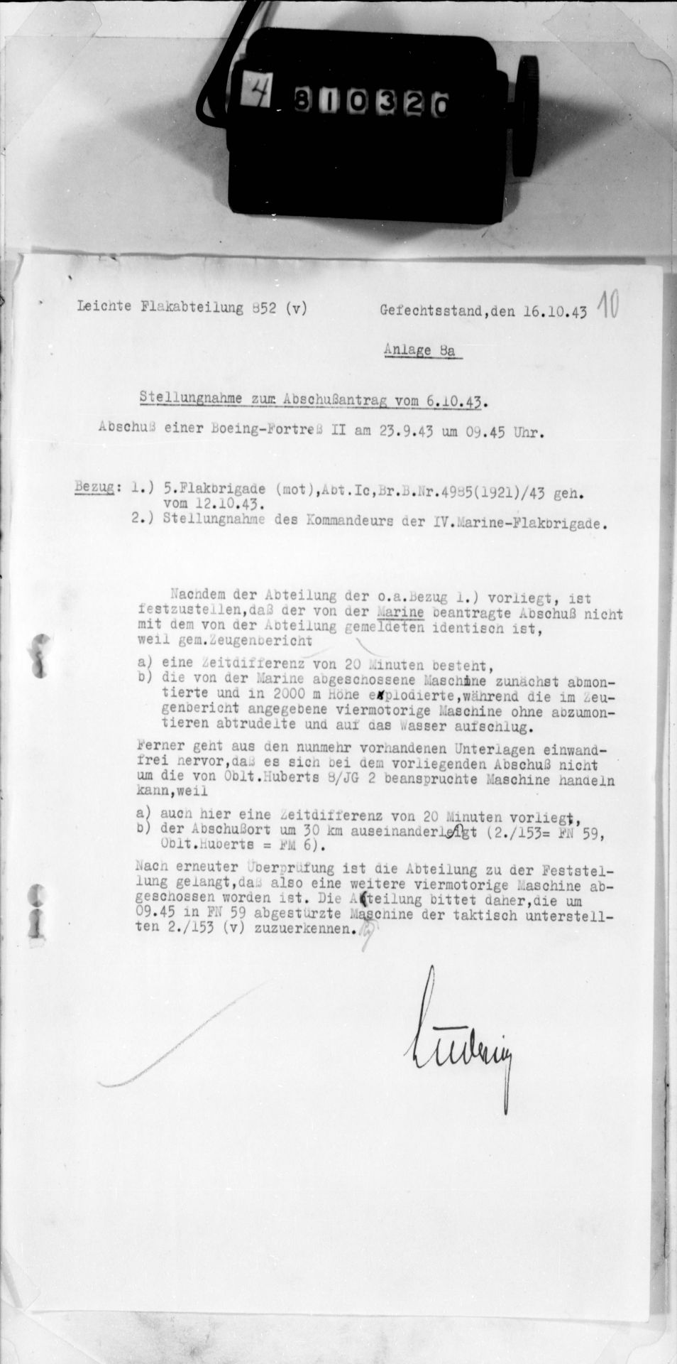
♦ Document T321-0061-00998 : Leichte Flakabteilung 852 (v) - 16.10.1943
Comment regarding the claim of October 6, 1943. Claim of a Boeing Fortress II on September 23, 1943 at 9:45 am.
" Reference :
1.) 5th Flakbrigade (mot), Abt.Ic, Br.B.Nr.4985(1921)/43 secret dated 12/10/43.
2.) Comment from the Commander of the IV. Marine-Flakbrigade.
After reviewing reference 1) above, the detachment notes that the claim made by the Navy is not identical to the one reported by the detachment, because according to the testimony :
a) there is a 20-minute time discrepancy,
b) the aircraft shot down by the Navy first disintegrated before exploding at an altitude of 2,000 meters, while the four-engine aircraft mentioned in the testimony dived without disintegrating and crashed on impact with the water.
Furthermore, the now available documents clearly show that the downed aircraft cannot be the one claimed by Oberleutnant Hubert (Correction: Oblt. Huppertz Herbert) of 8./JG 2, because :
a) there is alsdo a 20-minute time discrepancy,
b) the location of the claim is 30 km away (2./153 = square FN 59, Huberts (Correction: Oblt. Huppertz Herbert) = square FM 6).
After further review, the detachment concluded that another four-engine aircraft had been shot down. The detachment therefore requests that the aircraft that crashed at 9:45 in square FN 59 be attributed to 2./153 (v), to which it is tactically subordinate.
IN MEMORIAM
Below are photos taken at the "Tablets of the Missing" in the American military cemetery in Cambridge (England) concerning some of our airmen :
♦ Eugene WILCOX Jr

Photo with courtesy of Geoffrey Gillon - source website Find a grave
♦ Ralph Francis LEWIS
Ralph LEWIS has his name on the "Tablets of the Missing" in Cambridge as well as a memorial tomb Santa Fe Cemetery, New Mexico (USA).

Photo website Find a grave

Cimetière de Santa Fe, Nouveau Mexique (USA)
Photo with courtesy of Linda Blakeney, site Find a grave
♦ Victor Carl THOENDEL

Photo with courtesey of Geoffrey Gillon - source website Find a grave
APPENDICES :
♦ Document T321-0061-00991
♦ Document T321-0061-00992
♦ Document T321-0061-00993
♦ Document T321-0061-00994
♦ Document T321-0061-00995
♦ Document T321-0061-00996
♦ Document T321-0061-00997
♦ Document T321-0061-00998
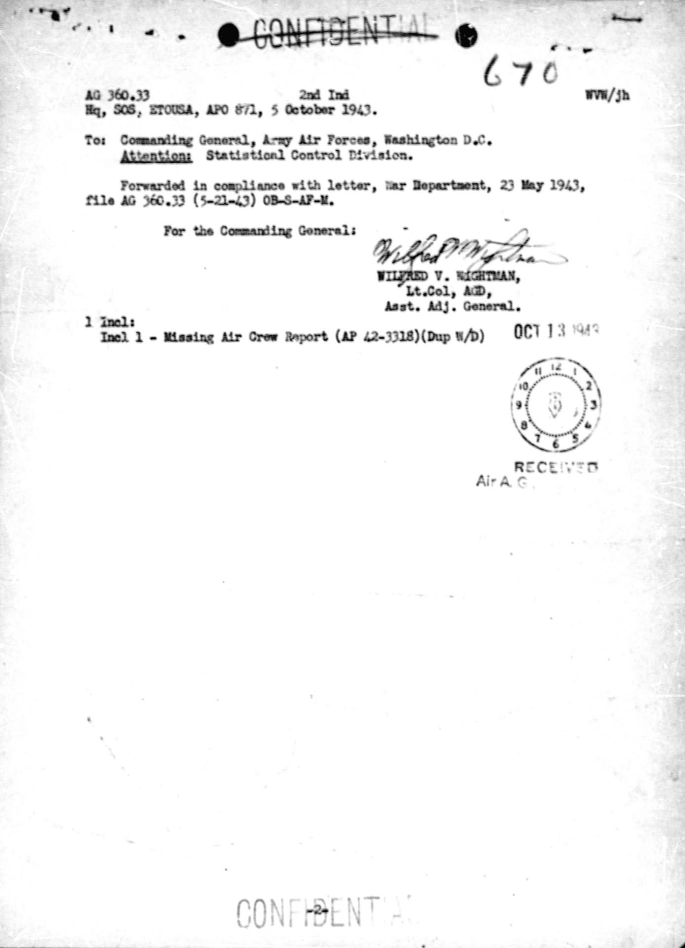
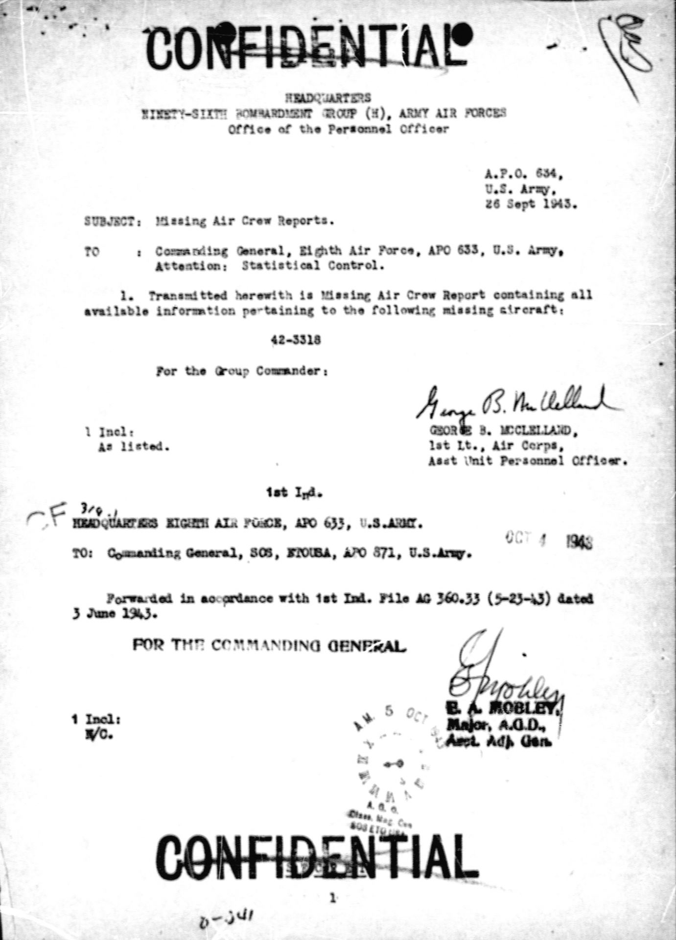
♦ Missing Air Crew Report # 670
This loss report gives us little information : the list of the missing crew with their role on board, rank and service number, the serial numbers of the aircraft and its engines, and the addresses of the parents of the unfortunate airmen.
♦ Victor's wedding announcement

Document with courtesy of Bonnie Sisson Manning - source website Find a grave
Sources :
- documents US NARA - T321, Records of Headquarters of the German Air Force High Command (documents en annexes)
- US National Archives
Ajouter un commentaire